

52.5123° N, 2.0811° W
 |
Other UK GeoparksHighland mountains, ocean cliffs, billion year old rocks and cavernous caves. The UK's 9 Geoparks are part of a global network of over 200 areas of exceptional geological significance.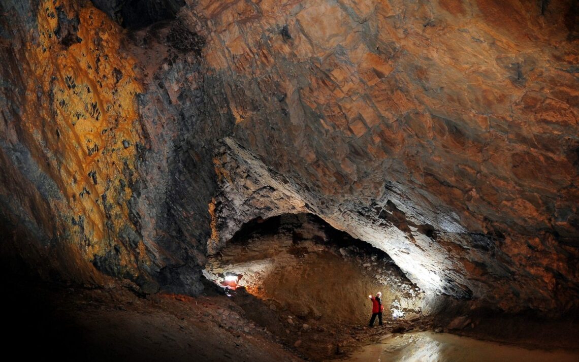
Black CountryGeographical Coordinates 52.5123° N, 2.0811° W
The Black Country played a major role in the creation of the modern world. It was here that the Industrial Revolution was at its most intense. It is a unique place, packed with incredible and surprising heritage features and colourful stories to be discovered. The Black Country became a UNESCO Global Geopark on Friday 10 July 2020 in recognition of the international importance of its natural and cultural heritage. BCG | Black Country Global Geopark (dudley.gov.uk) 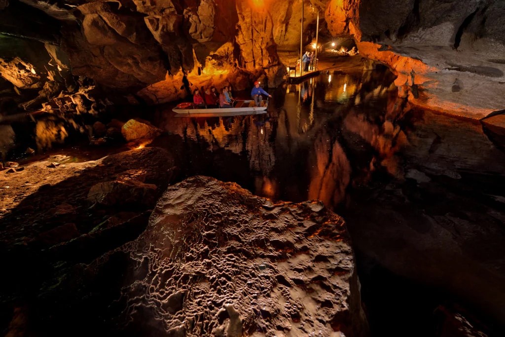
Cuilcagh LakelandGeographical Coordinates 54.1530°N 7.4852°W
Ranging from rugged uplands, lakes and forests through to gently rolling drumlins, the landscapes of the Global Geopark represent a complex Earth history dating back as far as 895 million years. With evidence of mountain building and destruction; searing hot deserts and warm tropical oceans; and of icy wastelands and water-worn caverns, the rocks and landscapes of the Global Geopark are nothing short of amazing.
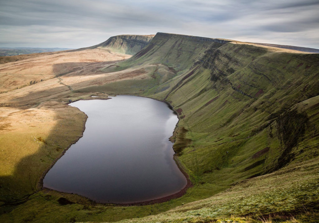
Fforest FawrGeographical Coordinates 51.51°N 3.35°W
A swathe of upland country which forms the western half of the Brecon Beacons National Park. It is a cracked and crumpled layer-cake of rocks, 480 million years in the making, a landscape sculpted by ice then transformed by man and a witness to the birth of the Industrial Revolution. Fforest Fawr | UNESCO Global Geopark (fforestfawrgeopark.org.uk)

GeoMônGeographical Coordinates 53.17°N 4.20°W
The tectonic island of Anglesey includes more than a hundred different rock types and the oldest fossils in England or Wales within 1,800 million years of Earth’s history., GeoMon is the United Kingdom’s most geologically diverse Global Geopark. Such is the variety of shapes and types of rock, that visitors and locals alike cannot but marvel at the magnificent colours and structures visible around the coast of the Welsh Global Geopark. GeoMôn UNESCO Global Geopark (geomon.co.uk)

Mourne Gullion Strangford
Geographical Coordinates 54.1533°N 6.0663°W
The Geopark’s spectacular beauty has been forged by nature, torn apart by volcanic activity and sculpted by ice, providing a stunning backdrop to a thriving locality where people continue to live and work. The exceptional geology of the Geopark has led to a remarkable range of natural and semi-natural habitats. All of these combine to make a varied mosaic of heather, moor, bog and pasture, dotted with freshwater and woodlands, and meeting sand and rocky shores, mudflats and salt marsh. 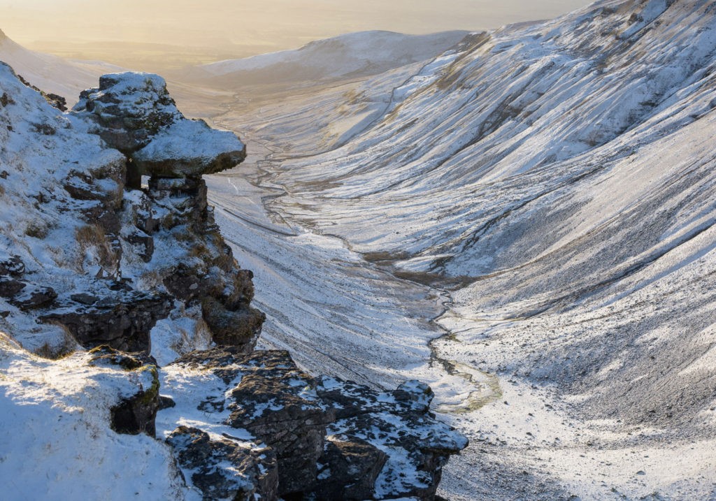
North PenninesGeographical Coordinates 54.44°N 2.8°W
The North Pennines landscape has been 500 million years in the making and reveals a story of tropical seas, vast deltas and deserts, huge ice sheets and continents on the move, alongside a world-class mineral and mining heritage. In recognition of its unique qualities, the North Pennines has been designated as an Area of Outstanding Natural Beauty (AONB), as well as a European and Global Geopark – highlighting its globally important Earth heritage.
UNESCO Global Geopark – North Pennines AONB
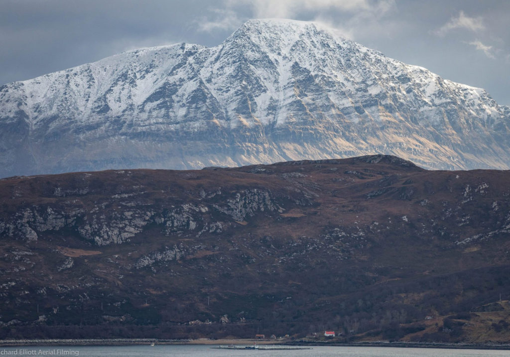
North West Highlands
Geographical Coordinates 58.7°N 5.8°W
Located in the far north of the Scottish Highlands, the Global Geopark is home to the oldest rocks in the United Kingdom. Their Lewisian gneiss is over 3 billion years old! The eastern boundary of the Global Geopark extends beyond the settlement of Durness and Loch Eriboll to follow the Moine Thrust Zone, an internationally significant geological structure that helped 19th-century geologists determine how the world’s great mountain ranges were formed.
NORTH WEST HIGHLANDS UNESCO GLOBAL GEOPARK - North West Highlands Geopark (nwhgeopark.com)
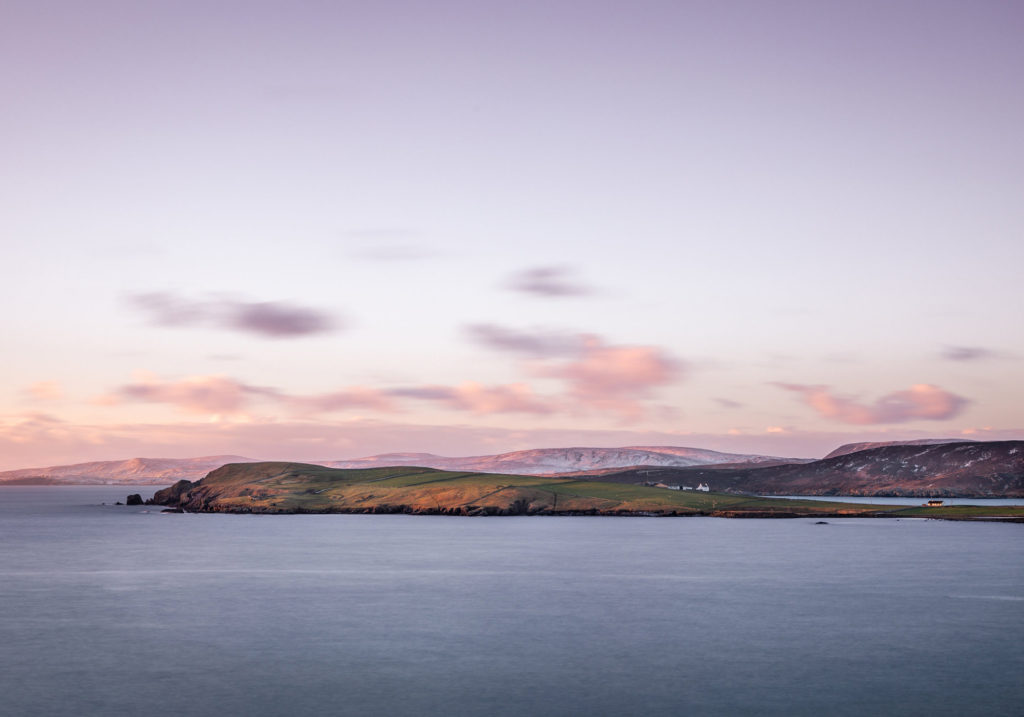
Geopark Shetland
Geographical Coordinates 60.21°N 1.13°W
From the highest sheer cliffs in Britain to the best ‘hands on’ exposure of the Great Glen Fault, Shetland is packed with incredibly varied geology spanning almost 3 billion years. Where else can you walk on an ancient ocean floor, explore an extinct volcano and stroll across shifting sands in the space of a day?
Shetland UNESCO Global Geopark | Shetland Amenity Trust
DISCOVER 58 UNESCO SITES IN THE UKFrom expansive mountain ranges and stunning coastlines to vibrant cities and rural landscapes – the UK’s UNESCO sites are destinations of world-class natural and cultural heritage.UNESCO sites in the British Isles include 29 World Heritage Sites, 13 Creative Cities, 9 Global Geoparks and 7 Biosphere Reserves |